When I started mapping the then newly established backcountry campsites in the Black Forest back in 2017, I discovered, that the current mapping quality of campgrounds in Openstreetmap is actually quite poor. Unfortunately this situation did not improve that much since then.
Being active in OSM for more than 10 years now, I also know that improvements will only happen, when there is an appropriate special interest map which will help motivate people to improve tagging.
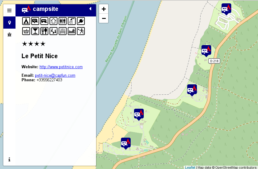
So here comes Open Camping Map!
It is provided in the hope, that it will help getting mappers to improve the tagging. There is a bugs section and an edit button besides the actual info about a particular site. The Map will likely be of interest also to camping enthusiasts just looking for a site in a particular area.
Some statistics about the current (bad) state of campsites in Openstreetmap. There are about 120000 camping and caravan sites in our database. About 35000 of them do not even have a name tag. Another 39000 of them do only have a name tag and nothing else. Thus about half of the campsite data in Openstreetmap is of no further value than drawing a (sometimes named) tent on a rendered map.
Wouldn’t it be nice to use Openstreetmap to locate a suitable campsite for your next bicycle or hiking trip or just for your ordinary summer camping holiday?
I do think so, thus lets start and improve the map.
This task is even suitable for armchair mappers as most of the campsites do have a website nowadays. Probably I should also think about adding this to StreetComplete or MapRoulette challenge.
Finally here are some issues I came about while coding this map:
- Duplicating campsites as node and way ist not a good idea. Please map the area only.
- Please add at least some contact data to make the data useful for potential customers of a site.
- caravan only pitches inside a campsite should not to be tagged as caravan_site.
camp_site=camp_pitchwould be a better option. - I invented a tag called
permanent_camping=yes,no,onlyas it is common on many sites in Germany, that people rent a pitch on a seasonal basis and do not move their caravan for years. There are even sites where this is the only option.
So where will I go from here. I intend to make the map multilingual and probably add more improvement on the next Karlsruhe Hack Weekend. I will be happy about further suggestions for improvements or (even better) patches.
The backend is based on PostGIS and Imposm and the associated configuration is also available at GitHub. It is likely suitable for other POI maps. Thus feel free to contact me if you like to build one! The most easy frontend for such a map will likely be uMap.
Happy campsite mapping!
Neueste Kommentare